- Unleashing the Power of 3D: A Comprehensive Guide to Google Earth’s GlTF Models
- From Virtual to Reality: How to Utilize Google Earth’s GlTF Models for Your Projects
- Breaking Down the Barriers: The Impact of Open Access to Google Earth’s 3D Models on the IT Industry
- Step-by-Step Tutorial: How to Integrate Google Earth’s GlTF Models into Your Applications
Unleashing the Power of 3D: A Comprehensive Guide to Google Earth’s GlTF Models
Google Earth has long been a popular tool for exploring our planet from the comfort of our homes. With the recent announcement that Google Earth’s GlTF models are now open for all, the possibilities for 3D visualization and exploration have expanded exponentially. GlTF, or GL Transmission Format, is a versatile, open-standard 3D file format that allows for efficient and high-quality rendering of 3D models. By opening up access to these models, Google Earth is enabling developers, designers, and enthusiasts alike to harness the power of 3D in their projects and applications.
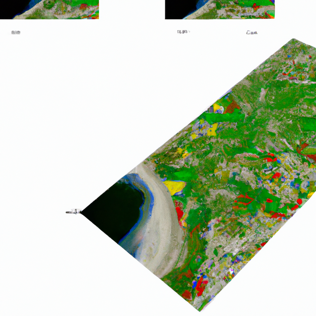
One of the key advantages of using GlTF models in Google Earth is their ability to provide a more immersive and realistic experience for users. These models are created using detailed satellite imagery and elevation data, resulting in accurate representations of real-world locations. This level of detail allows users to explore and interact with the environment in a way that was previously only possible through expensive and time-consuming 3D modeling processes.
Another benefit of Google Earth’s GlTF models is their compatibility with a wide range of platforms and applications. As an open-standard format, GlTF models can be easily integrated into various 3D rendering engines, game engines, and virtual reality platforms. This flexibility makes it easier for developers to create engaging and interactive experiences that leverage the power of 3D visualization, without being limited by proprietary formats or software restrictions.
For those looking to utilize Google Earth’s GlTF models in their projects, there are several resources available to help get started. Google provides extensive documentation on how to access and use these models, as well as sample code and tutorials for integrating them into popular 3D engines like Unity and Unreal Engine. Additionally, there are numerous online communities and forums dedicated to sharing tips, tricks, and best practices for working with GlTF models in various applications.
In conclusion, the open access to Google Earth’s GlTF models represents a significant milestone in the world of 3D visualization and exploration. By providing high-quality, accurate, and versatile 3D models, Google Earth is empowering developers, designers, and enthusiasts to create more immersive and engaging experiences than ever before. Whether you’re building a virtual reality tour of a historic site, creating a realistic simulation for urban planning, or simply exploring the world from your living room, the possibilities are now truly limitless.
From Virtual to Reality: How to Utilize Google Earth’s GlTF Models for Your Projects
Integrating Google Earth’s GlTF models into your projects can greatly enhance the realism and interactivity of your applications. Whether you’re working on architectural visualizations, educational tools, or virtual reality experiences, these 3D models can provide an unparalleled level of detail and accuracy. In this section, we’ll explore some of the key steps and considerations for utilizing Google Earth’s GlTF models in your projects.
First, you’ll need to access the GlTF models from Google Earth. This can be done using the Google Earth API, which allows you to query and download 3D models for specific locations. To get started, you’ll need to sign up for a Google Earth API key, which can be obtained from the Google Cloud Platform Console. Once you have your API key, you can use it to make requests for GlTF models using the following endpoint:
https://earth.google.com/tours/api/v1/models/{latitude},{longitude}?key={YOUR_API_KEY}
Replace {latitude}, {longitude}, and {YOUR_API_KEY} with the appropriate values for your desired location and API key. The API will return a GlTF model file, which can then be imported into your 3D rendering engine or application of choice.
When working with GlTF models in your projects, it’s important to consider the performance implications of rendering complex 3D scenes. Depending on the level of detail and the number of models in your scene, rendering performance can be impacted, particularly on lower-end devices. To optimize performance, consider using techniques such as level of detail (LOD) management, which allows you to display lower-resolution models when objects are further away from the camera, and occlusion culling, which prevents rendering of objects that are not visible to the user.
Finally, when integrating Google Earth’s GlTF models into your projects, it’s essential to respect the terms of use and licensing restrictions associated with the models. Google Earth’s 3D models are provided for non-commercial use only, and any applications or projects that utilize these models must adhere to the Google Earth API terms of service. By following these guidelines and best practices, you can create engaging and immersive experiences that leverage the power of Google Earth’s GlTF models while respecting the rights of the content creators.
Breaking Down the Barriers: The Impact of Open Access to Google Earth’s 3D Models on the IT Industry
The decision to make Google Earth’s GlTF models openly accessible has far-reaching implications for the IT industry. By providing high-quality 3D models of real-world locations, Google is democratizing access to advanced visualization tools and resources that were once reserved for large corporations and specialized professionals. This shift has the potential to level the playing field for smaller developers, startups, and independent creators, enabling them to create more sophisticated and immersive applications without the need for expensive 3D modeling software or expertise.
One of the most significant impacts of open access to Google Earth’s GlTF models is the potential for innovation in the fields of virtual and augmented reality. With access to accurate and detailed 3D models, developers can create more realistic and engaging VR and AR experiences, such as virtual tours, educational applications, and location-based games. This could lead to a surge in the development of new and innovative applications that leverage the power of 3D visualization, ultimately driving the growth and adoption of VR and AR technologies.
Another area where open access to Google Earth’s GlTF models could have a profound impact is in the realm of urban planning and architecture. By providing accurate 3D representations of real-world locations, these models can help architects and urban planners visualize and analyze the impact of proposed developments on the surrounding environment. This can lead to better-informed decision-making and more sustainable urban development practices, ultimately benefiting both the industry and the communities they serve.
Furthermore, the availability of Google Earth’s GlTF models can also benefit the education sector, particularly in the fields of geography, history, and environmental science. Educators can use these models to create interactive and engaging learning experiences that help students better understand and appreciate the world around them. By incorporating 3D visualization into their curricula, educators can foster a deeper connection between students and the subject matter, ultimately enhancing the learning experience.
In conclusion, the open access to Google Earth’s GlTF models represents a significant opportunity for the IT industry and beyond. By breaking down the barriers to high-quality 3D visualization, Google is empowering developers, architects, educators, and other professionals to create more engaging and immersive experiences that leverage the power of 3D technology. As a result, we can expect to see a wave of innovation and growth in various sectors, ultimately benefiting both the industry and the end-users of these applications.
Step-by-Step Tutorial: How to Integrate Google Earth’s GlTF Models into Your Applications
Integrating Google Earth’s GlTF models into your applications can greatly enhance the user experience by providing realistic and detailed 3D representations of real-world locations. In this tutorial, we will walk you through the process of integrating these models into a simple application using the popular 3D engine, Unity.
Step 1: Obtain a Google Earth API Key – Before you can access Google Earth’s GlTF models, you’ll need to sign up for a Google Earth API key. This can be done by visiting the Google Cloud Platform Console and creating a new project. Once you have your API key, you’ll be able to make requests for GlTF models using the Google Earth API.
Step 2: Download and Import the GlTF Model – Using the Google Earth API, request the GlTF model for your desired location by providing the latitude, longitude, and your API key. Once you have downloaded the GlTF model, you’ll need to import it into Unity. To do this, you can use a plugin like the UnityGLTF library, which can be downloaded from the Unity Asset Store. Import the library into your Unity project, and then use the provided scripts to load and display the GlTF model in your scene.
using UnityEngine;
using UnityGLTF;

public class LoadGoogleEarthModel : MonoBehaviour
{
    public string ApiKey;
    public float Latitude;
    public float Longitude;

    private async void Start()
    {
        string url = $"https://earth.google.com/tours/api/v1/models/{Latitude},{Longitude}?key={ApiKey}";
        var gltfComponent = gameObject.AddComponent();
        gltfComponent.GLTFUri = url;
        await gltfComponent.Load();
    }
}
Step 3: Configure the Scene – Once the GlTF model is loaded into your Unity scene, you may need to adjust its position, scale, and rotation to fit your application’s requirements. You can do this using Unity’s built-in Transform tools. Additionally, you may want to add lighting, cameras, and other scene elements to enhance the visual appearance and interactivity of your application.
Step 4: Build and Test Your Application – After configuring your scene and integrating the Google Earth GlTF model, you can build and test your application on your target platform. Ensure that the model loads correctly and that the performance is acceptable on your target devices. If necessary, consider optimizing the model or scene to improve performance and reduce loading times.
By following these steps, you can successfully integrate Google Earth’s GlTF models into your Unity applications, providing users with a more immersive and engaging experience. Keep in mind that this tutorial is just a starting point, and there are many other ways to utilize these models in various applications and platforms. With the power of Google Earth’s GlTF models at your disposal, the possibilities for creating captivating 3D experiences are truly limitless.


0 Comments